New Insights: Supporting the Delivery of Long-Term Care Homes in Ontario
SERVICES
Surveying
We help clients make confident decisions through accurate, reliable surveying for planning, engineering, construction, and legal surveys. As licensed members of the Association of Ontario Land Surveyors (AOLS), we are authorized to provide legal boundary (cadastral) surveying services in Ontario.
Precise data. Confident decisions.
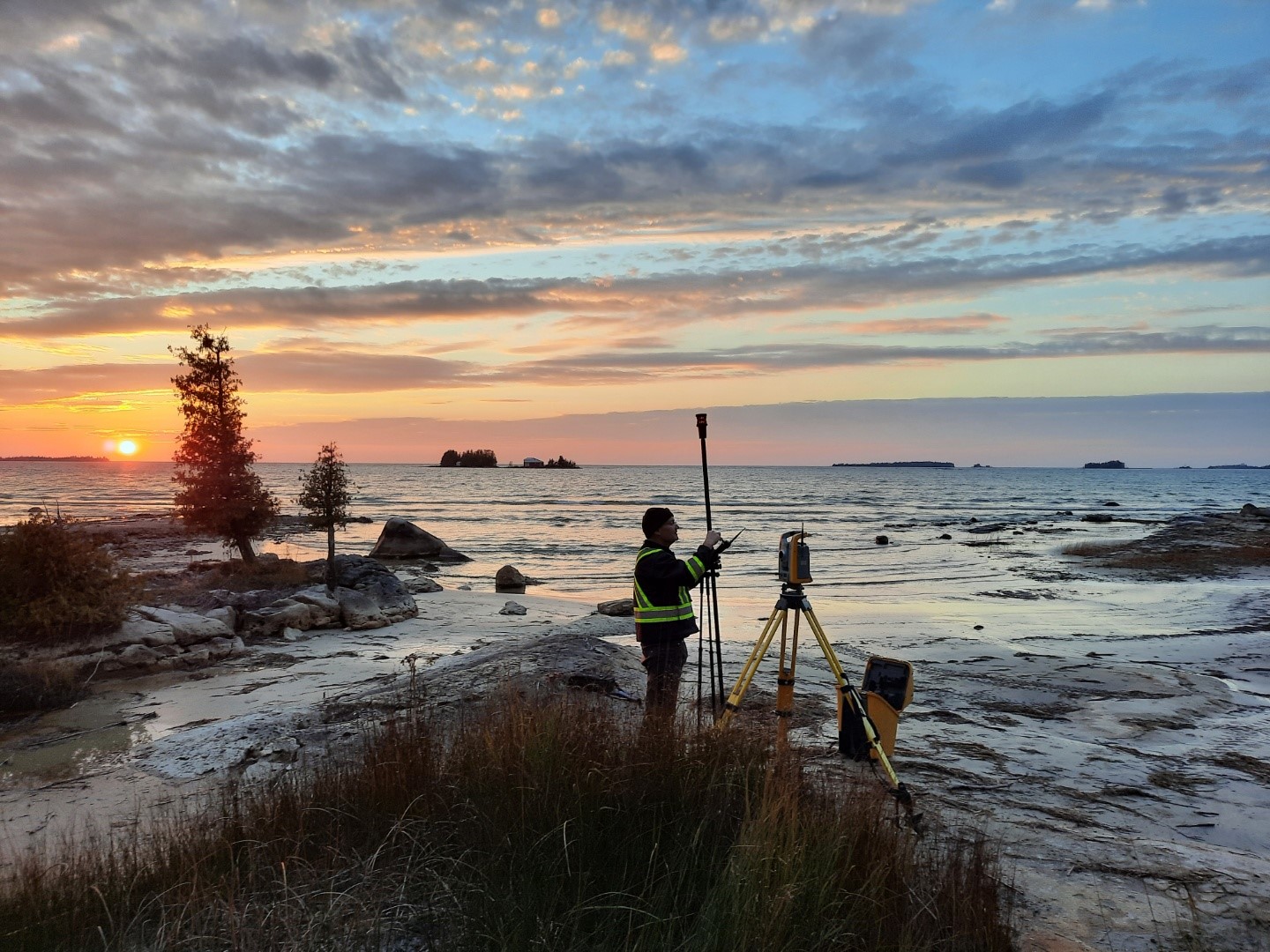
Our surveying team provides high-accuracy data for every stage and type of project. From topography and legal boundaries to construction layout and deformation monitoring, we deliver the measurements and mapping that clients need to design and build with precision and certainty.
Topographical surveys
Our surveyors deliver high-precision topographical surveys using modern survey equipment and techniques to capture all relevant site data. These surveys form the basis for Existing Conditions Plans that support accurate design and reduce construction delays as well as additional costs.
We provide detailed topographic data and mapping services in the following areas:
- Residential Land Development Projects
- Commercial, Industrial and Residential Site Development Projects
- Road Reconstruction
- Road and Rail Route Planning
- Flood Analysis and Contours
- Pipeline Routing
- Delineation of Environmental Impact Areas
- Drainage Studies
- Gravel Pits and Quarries
- Volume Calculations for Payment Certification

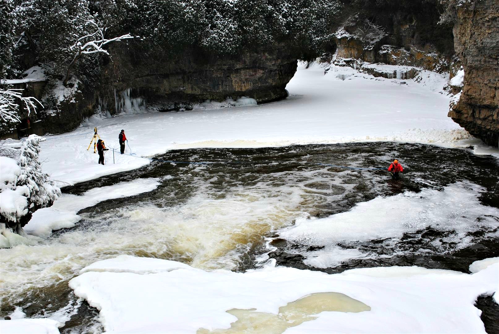
Bathymetric surveys
Our team can provide bathymetric surveys of ponds, shallow lakes and shorelines to support in-water projects, including:
- Assessment of below water slope stability of aggregate pit ponds
- Volumetric estimates for dredging
- Maintenance of stormwater management ponds
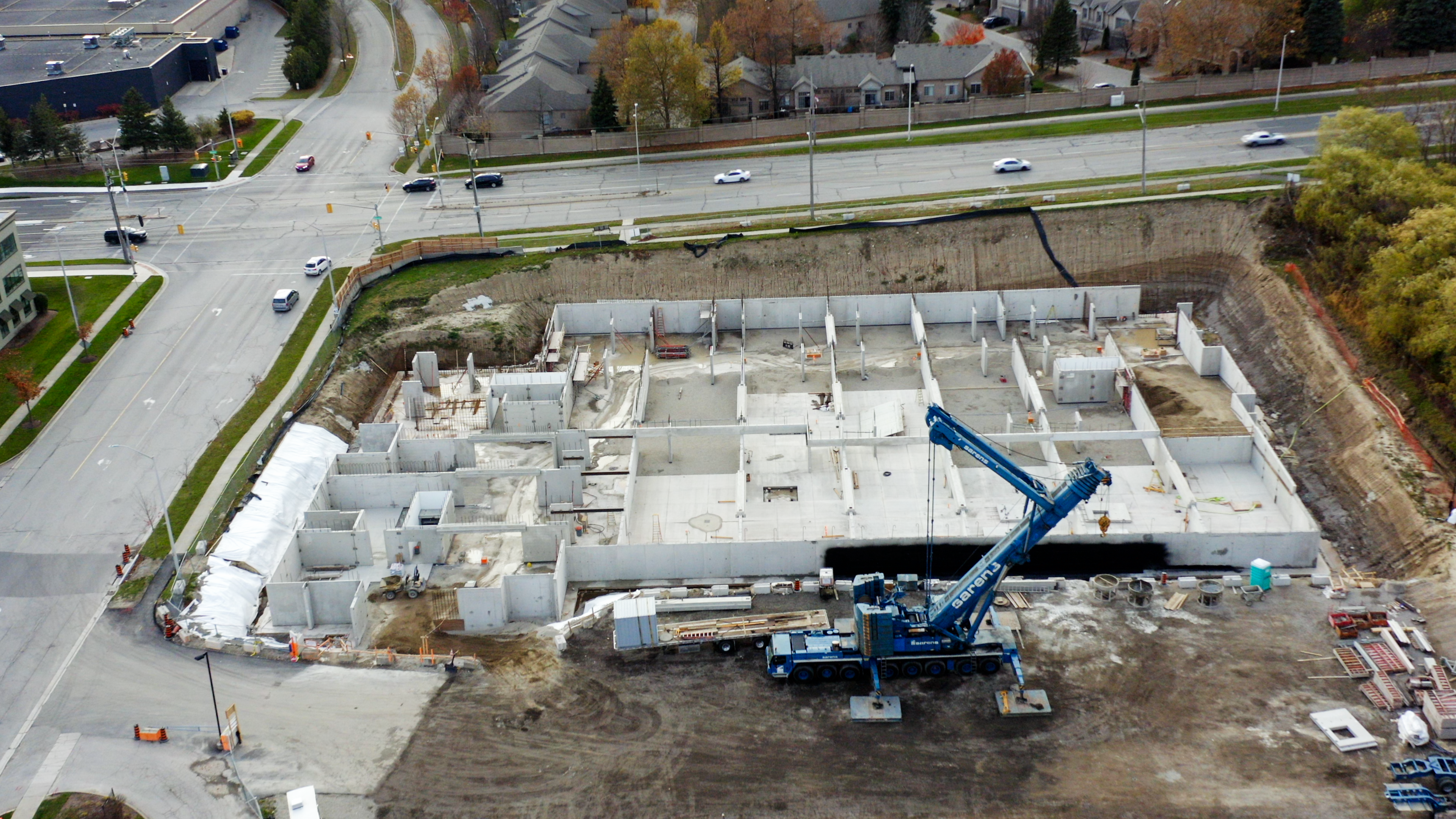
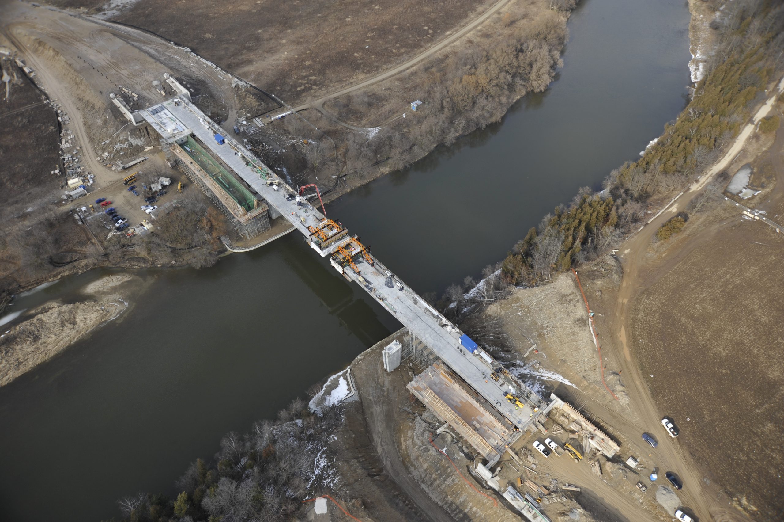
Construction surveys
We provide precise layouts for many types of construction projects including but not limited to:
- Building and Structure Layout
- Bridge and Culvert Layout
- Grading Layout
- Underground Servicing Layout
- Road, Highway and Curb Layout
- Electrical Layout
- As-Built Plans
- 3D Surface Modelling for Contractor’s GPS and Machine Control Systems
- Volume Calculations and Reporting
- Utility line staking
Deformation monitoring
We perform deformation monitoring using high-precision instruments to track structural movement. Our team compares data over time to identify movement to support engineering assessments, analysis of structural integrity and public safety.
Our deformation monitoring services include:
- Building Foundations
- Bridge Foundations and Control Joints
- Dams Investigations and Monitoring
- Retaining Walls
- Surface features on tunnelling projects
Legal boundary surveys
We help clients clearly define their property with accurate legal boundary surveys. Our licensed Ontario Land Surveyors combine legal expertise and modern technology to support projects across the public and private sectors.
- Plans of Subdivision
- Various types of Plans of Condominium
- Various types of Reference Plans
- Surveyor’s Real Property Reports (residential surveys)
- Plans of Survey (commercial, industrial, etc.)
Request a quote or existing survey
Need a survey for your property or project? Whether it’s a legal boundary survey or engineering support, our team is here to help. Use the form below to select the services you need, and we’ll provide a quote based on the details you share.
Please note: current turnaround times for new surveys range from 2–8 weeks.
See how we bring projects to life
Start your next project
From planning and approvals to construction and compliance, our team delivers technical insight and responsive service every step of the way.
© Copyright 2026. All Rights Reserved